Journal entry, Tuesday September 28, 2004:
Tropical Storm Jeanne
Atlanta, GA.
Sunday night's sunset was absolutely spectacular. The Cirrus clouds were up about
40-50,000 feet, and preceded Tropical Storm Jeanne by 12 hours. These huge, floating ice crystals lit up the southwestern
sky with brilliant orange, red, purple and dark blue. As the Sun's unlimited nuclear energy slowly faded to twilight, and
eventually darkness, the temperature fell proportionally with the increasing darkness. The wind remained surprisingly calm.
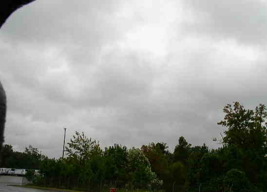
Upon awakening this morning, the cloud cover had lowered dramatically, and the wind speed
has increased to a few miles per hour. Clouds that were over 8 miles high have been replaced with clouds that are only a
couple of thousand feet above ground and are moving rapidly towards the West. I interpreted this to mean that I was now
under the Northwestern edge of Jeanne.
The rain started at 9 a.m. with very small droplets, and it stayed that way for much of the
day, even though the wind speed increased. During the late afternoon, the intensity of the rain increased, but the numerous
droplets still remained relatively small. Sunset was not nearly memorable as last night's was because it was obscured by the
swirling clouds and rain.
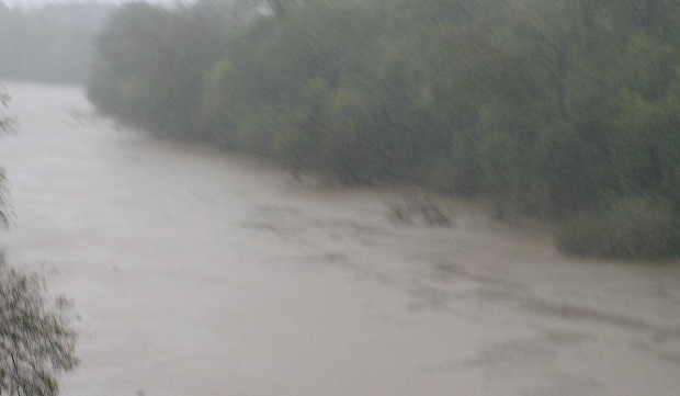
Rain, rain, rain...! At 8 p.m., I drove over to deliver my trailer load and pickup
an empty to take to my next shipper. Enroute, I saw the ditches and drainage grates starting to fill and overflow with chocolate-brown
water that contained an occasional twig or branch. My thoughts were that it really wasn't a lot of rain, but then
I realized that the droplets were not "thunderstorm-size", but nonetheless they were really coming down in great numbers.
I guess I could equate it to the old phrase, "It's quantity, not quality," and not the other way around.
By now, the main part of Jeanne was hammering South and North Carolina. I couldn't imagine
what it was like there because where I was, the "loop" around Atlanta was crawling at about 10 MPH. (Of course, they drive
about 20-30 MPH when a "regular" storm passes through. Go Figure...)
The numerous low spots on Interstate 285 were accumulating water to a depth of 3-5 inches
and there were already several accidents between the warehouse I had just left and where I had to go pickup my next load.
This just compounded the traffic problem. By the time I arrived, the wind speed was around 40 MPH and the small but numerous
droplets were falling horizontally.
The Trucking Gods were with me that night because when I arrived at the warehouse to pickup
my pre-loaded trailer, the previous "arm" of the storm had passed and the next one hadn't arrived yet, so the incessant rain
had taken a short-lived breather. Nonetheless, the parking lot had about 2" of standing water for me to stomp around in and
soak my socks. Get a soaked head, or get soaked toes? At least is wasn't head-to-toe.
As I hooked up to the loaded trailer and performed a quick pre-trip inspection (that's right:
rain, snow, heat, cold- it still has to be done...), I quickly updated my logbook and tuned into the Weather Channel on my
Sirius Radio to find out where I would run out of the storm. The information given was that as soon as I hit the Georgia/Tennessee
line, it would be clear. I didn't think that meant literally, but that was the case about 2 hours later as I ran out from
underneath the canopy of the storm.
Unreal! From pounding rain and high winds, to a crystal clear, moonlit sky. That's Mother
Nature...